How Alabama Drone Pros Uses Thermal Imaging for Wildlife Assessment

Thermal imaging wildlife assessment in Alabama uses an aerial infrared sensor to detect heat contrast and help survey wildlife or habitat from above. For landowners, wildlife managers, and conservation-minded property teams, drone imagery can add useful observations where ground access is difficult. It does not identify every animal or replace field expertise: vegetation, weather, terrain, flight planning, and the survey goal all affect what a sensor can reveal.
At Alabama Drone Pros, our FAA-certified pilots use thermal imaging as one tool within a tailored drone assessment, with safety and the intended use guiding the plan.
Three things to know before you go further:
- Thermal shows heat contrast: A bright or dark area on a thermal view indicates a difference in detected heat, not a confirmed species or animal count.
- Conditions shape the view: Canopy, ground cover, ambient temperature, and the timing of a flight can limit the contrast between an animal and its surroundings.
- Purpose matters: A habitat assessment, a search for an animal, and a hunting-related activity can have different rules and operational needs.
Key takeaways
Drone thermal imaging can support wildlife assessment, but a useful result depends on a clear survey question, suitable conditions, and careful interpretation.
Practical points at a glance
Why wildlife can be hard to assess from the ground

The challenge is coverage and visibility
Wildlife assessment often involves more than asking whether an animal is present. A land manager may need to understand where activity is occurring, whether a property has areas that are difficult to inspect on foot, or what sections deserve closer field attention. On large or uneven properties, brush, water, steep ground, and limited access can make a ground survey slow or incomplete.
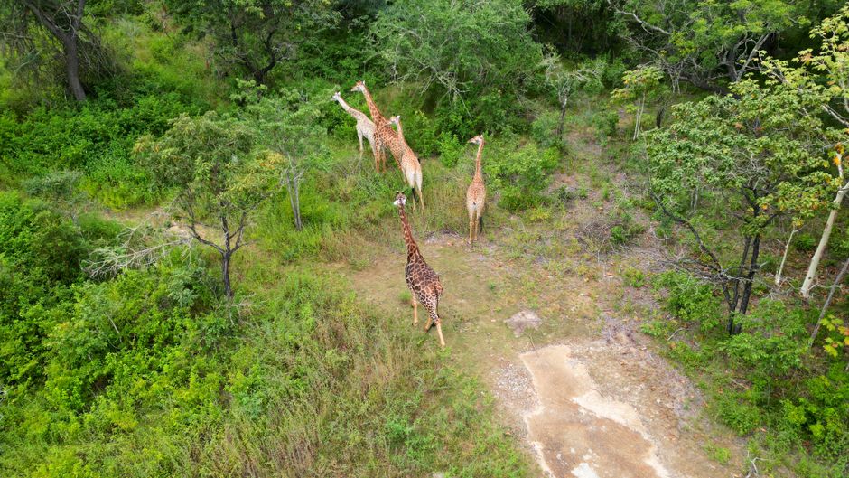
A drone can provide an overhead view of a defined area. With a thermal sensor, that view may also show heat contrast that is less apparent in ordinary visible-light imagery. This can help a team prioritize locations for further review, but it cannot see through solid objects, and dense foliage may obscure animals from above.
A heat signature is not an identification
Thermal images show detected infrared energy, which viewers interpret as patterns of relative warmth. An animal may appear as a distinct heat signature against cooler surroundings, but other warm objects and changing surface conditions can create confusing patterns. The image alone may not tell a viewer whether a target is a particular species, how many animals are present, or what the animal is doing.
That distinction matters in Alabama wildlife management. Property owners and wildlife professionals need observations they can interpret responsibly, not a confident-sounding conclusion drawn from a single image. Thermal data can guide a follow-up inspection or help document an area, while field context and qualified judgment remain essential.
Conditions influence the value of a survey
Sun-warmed ground, recent weather, thick vegetation, and changing temperatures can reduce contrast or create background variation. Flight height, route, camera angle, sensor resolution, and the boundary of the survey area also affect how useful the collected imagery is. A flight that is too broad for the question may produce plenty of images but little actionable detail.
The cost to the reader is often time and uncertainty rather than a predictable dollar amount. A poorly planned survey can lead to extra flights, unnecessary ground searches, or misplaced confidence in an incomplete observation. Planning around the actual property and purpose helps avoid those problems.
For background on the equipment and aerial approach, read about our thermal imaging drone services. Our Wildlife Assessment page explains how this work fits into a broader property assessment.
How we plan a thermal wildlife assessment

A practical workflow from question to review
A useful assessment starts with a defined objective, not simply launching a drone and collecting footage. We plan the work around the site, the intended use of the information, and conditions that may affect thermal visibility. The exact approach depends on the property and operating requirements.
- Define the survey question: Clarify whether the goal is to assess wildlife activity, review a habitat area, or locate a specific animal. A focused question helps determine the area, timing, and kind of imagery that may be useful.
- Review the site and access: Identify the property boundary, terrain, trees, water, structures, launch options, and sensitive areas. This helps the pilot plan a route and avoid assuming that every portion of a property can be observed from the air.
- Check conditions and constraints: Consider visibility, wind, temperature patterns, vegetation, and other conditions that can affect the flight or image interpretation. Confirm applicable airspace, permissions, and local rules before the operation.
- Plan the flight pattern: Set a route and coverage approach suited to the survey area and the question. Flight height and speed involve a practical balance: broad coverage can help survey a larger area, while a more focused pass may be needed to examine a location more closely.
- Capture thermal imagery with context: Collect the planned thermal view and, where appropriate, supporting visual imagery. A thermal image is easier to interpret when its location and survey context are clear, rather than treated as an isolated bright spot.
- Review observations cautiously: Look for patterns that may warrant attention, while considering possible background heat sources and visibility limits. Treat an aerial indication as an observation to assess, not automatic confirmation of species, count, or behavior.
- Connect the results to next steps: Share relevant observations in a way that supports the client's purpose, such as identifying areas for a ground check or further assessment. If the initial question cannot be answered reliably from the available imagery, explain that limitation rather than overstating the finding.
Pro Tip: If a property has heavy tree cover, identify open corridors, field edges, and accessible clearings during the planning conversation. Those site details help set realistic expectations about what a thermal flight may and may not show.
Our Thermal Imaging service is tailored to the operation rather than a one-size-fits-all flight. If you are planning a wildlife survey, talk with our team about a thermal assessment.
Common mistakes that weaken wildlife observations
Treating every thermal mark as an animal
A distinct-looking mark is not proof of a particular animal. Warm rocks, equipment, buildings, and sun-heated surfaces can produce thermal contrast, while vegetation can partly or completely block an animal from the sensor. Review the setting, compare imagery where possible, and keep conclusions proportional to the evidence.
Assuming the drone sees through canopy
Thermal sensors do not provide a view through dense leaves or branches. A flight over forested land may offer helpful information about open areas and edges, but it should not be described as a complete count of animals beneath a closed canopy. Be especially cautious about interpreting an absence of visible heat as proof that wildlife is absent.
Flying without a specific objective
A general request to “check the property” can leave the pilot and client with different ideas of success. One person may expect a habitat overview, while another expects animal identification or a search. Agree on the survey area and intended use before flight planning so the chosen route and reporting match the real question.
Ignoring legal and ethical limits
Rules can depend on jurisdiction, species, season, and purpose. For example, WAC 220-414-010: Hunting equipment restrictions states that it is unlawful to use or possess infrared or night vision equipment, thermal imaging devices, and comparable equipment, except trail cameras, while hunting, spotting, locating, or reporting the location of big game for the purpose of hunting, except as authorized by a permit.
Similarly, 040-2 Wyo. Code R. §§ 2-20 states that no person shall use a device attached to a legal firearm, muzzleloader, or archery equipment, capable of producing a thermal or infrared image, with the intent to spot, locate, and aid in the taking of any big game animal. These examples concern other jurisdictions, not a summary of Alabama law. Check the rules that apply to the specific place and purpose before proceeding.
Mistaking technical performance for field certainty
Research findings about image detection do not mean a particular field flight will identify animals reliably. For instance, Synthetic Thermal Image Generation for Real-Time Animal Detection Under Low-Visibility Conditions reports that synthetic thermal images provide competitive detection performance, with RT-DETR achieving the highest synthetic-data mAP@0.5 of 0.9613. That is a result about a specific synthetic-data evaluation, not a guarantee of field performance or a substitute for interpreting site conditions.
Pro Tip: Ask a drone provider how the team will distinguish a thermal observation from a confirmed identification, and what site or weather conditions could limit the result. A clear answer is a better sign of a responsible workflow than a promise to find every animal.
Frequently asked questions
What can a thermal drone reveal about wildlife?
A thermal drone may reveal heat contrast that helps a reviewer notice possible wildlife activity or identify areas for closer inspection. What appears in the image depends on the sensor, flight plan, vegetation, terrain, and environmental conditions. Thermal imagery does not automatically identify species, confirm an animal count, or show behavior.
It is most useful when treated as one source of information and interpreted alongside knowledge of the site and the purpose of the assessment.
Can drone thermal imaging see animals under trees?
No thermal sensor should be treated as if it sees through a dense canopy. Leaves and branches can block the sensor’s view, and ground cover can further reduce visibility. Openings, field edges, and clearings may offer a different view, but results still depend on conditions and flight planning.
If a property is heavily wooded, discuss those limits before the survey and consider whether aerial observations can answer the specific question at all.
Is thermal imaging wildlife assessment legal in Alabama?
The answer depends on the activity, location, applicable rules, and purpose of the flight or observation. Rules can differ across jurisdictions, especially where hunting or locating game is involved, so examples from another state should not be taken as Alabama guidance. Before scheduling a survey, identify the intended use and check the current rules that apply to the property and activity.
A drone provider can discuss operational planning, but clients should confirm relevant legal requirements.
What should I ask before hiring a drone wildlife assessment provider?
Ask whether the pilot is FAA-certified, how the flight area and route will be planned, what thermal equipment and imagery are included, and how limitations will be communicated. Explain the property’s tree cover, terrain, access issues, and assessment goal. Also ask what the deliverable can support and what would require ground verification.
A provider should be able to distinguish an observed heat pattern from a confirmed species identification and discuss conditions that could affect coverage.
How Alabamadronepros supports wildlife assessment
Alabama Drone Pros provides drone services for varied operational needs, including wildlife assessment and thermal imaging. Our FAA-certified pilots use advanced technology and tailor the approach to the site and the client’s objective. A wildlife survey may involve different planning considerations from a search for a lost pet or a drone deer recovery request, so the intended purpose needs to be clear before flight planning begins.
Depending on the request, our relevant services include:
- Thermal Imaging: Aerial thermal imagery for a defined assessment or search objective.
- Wildlife Assessment: A drone-based view to support evaluation of a property or wildlife-related question.
- Drone Deer Recovery: A separate service for eligible recovery needs, subject to the purpose, location, and applicable rules.
Our team does not treat thermal imagery as a guaranteed animal count or species identification. We focus on matching the operation to the request, communicating practical limits, and working safely. To discuss a property, a survey objective, or whether thermal imaging may fit your needs, contact Alabama Drone Pros to plan your assessment.
Conclusion: Plan thermal imaging wildlife assessment in Alabama around the question
Thermal imaging wildlife assessment in Alabama can help land managers and property owners review areas that are difficult to inspect from the ground, but the value depends on a realistic plan and careful interpretation. Thermal contrast is useful information, not automatic proof of species, count, or behavior. Canopy, weather, terrain, flight design, and legal purpose all shape what a drone survey can responsibly support.
The most important next step is to define the question you need answered before choosing a flight. Note the property boundaries, tree cover, terrain, and intended use, then discuss those details with a qualified drone provider. Alabama Drone Pros can help determine whether Wildlife Assessment and Thermal Imaging are a sensible fit for the request, and explain where aerial imagery may need to be paired with other assessment methods.